Executive Overview
For centuries, conventional historical wisdom has maintained that the conquering legions of the Roman Empire stopped short of the rugged landscapes of west Wales. Regency-era antiquarians, operating under assumptions that have stubbornly persisted into the modern day, argued that Rome’s administrative and military apparatus barely penetrated the remote expanses beyond Carmarthenshire. Generations of historians treated west Wales as a frontier untouched by the Pax Romana, dismissing local folklore and the accounts of early antiquarians as little more than romantic fabrication.
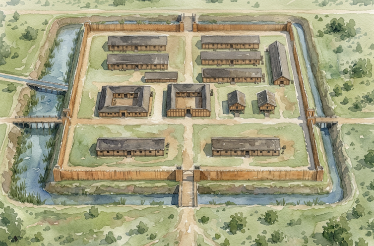
That historical consensus has now been shattered. Following decades of methodical, painstaking research, a team of archaeologists has confirmed the discovery of a major Roman auxiliary fort near the modern-day village of Crymych in north Pembrokeshire. Spanning approximately three hectares and featuring the classic "playing-card" silhouette characteristic of Roman military installations, the site provides definitive proof of a sophisticated Roman presence deep in territory long thought to be exclusively Celtic.
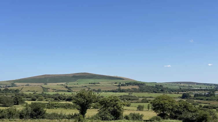
Even more extraordinary is the fort’s geographical and thematic proximity to medieval Welsh mythology. Situated just three kilometres southwest of the Frenni Fawr—the easternmost peak of the Preseli Hills—the newly identified fortification aligns remarkably with Cadair Maxen, the mythical camp of the late fourth-century Roman usurper Magnus Maximus (known in Welsh as Macsen Wledig), immortalized in the classic medieval collection of stories known as The Mabinogion.
By combining cutting-edge geophysical surveys, targeted trial excavations, and rigorous numismatic and ceramic analysis, researchers have brought to light a lost arterial road network and a timber fort likely established during the governorship of Sextus Julius Frontinus between AD 74 and 78. This discovery not only rewrites the military history of Roman Britannia but also serves as a striking validation of the adage that folklore is frequently anchored in historical reality.
Detailed Chronology: From 19th-Century Scepticism to 2025 Breakthroughs
The journey toward confirming the Crymych auxiliary fort was fraught with institutional resistance, shifting methodologies, and decades of piecemeal discoveries.
The Early Clues (2002–2012)
The modern phase of this historical detective story began in 2002, when researchers rediscovered a Roman villa situated roughly 30 kilometres west of the traditional boundaries of Roman influence in Wales. The site had originally been identified in the early 19th century by Richard Fenton, a local antiquarian whose reliability had long been cast into doubt. Regency-era skepticism regarding Roman incursions into west Wales had created an academic climate hostile to Fenton’s claims.
While excavating the villa, a local volunteer posed a fundamental question: What was a Roman site of such high status doing in the middle of nowhere? Seeking answers, the excavation team looked back to 1922, when pioneering archaeologist Sir Mortimer Wheeler excavated a similarly isolated site on the same latitude. Reasoning that both locations must have been anchored by an undiscovered Roman road network, researchers initiated a targeted quest to map ancient transit routes through west Wales.
Though a short stretch of Roman road had been identified by Fenton in the vale of Whitland and partially excavated in 1995 ahead of a bypass construction project, the wider network remained elusive. A major turning point occurred between 2012 and 2013 with the discovery of a Roman fort at Wiston, near Haverfordwest, alongside several previously unrecorded Romano-British villas. These finds injected fresh momentum into the theory that Rome’s footprint in the region was far more substantial than previously acknowledged.
The Breakthrough and Geophysical Surveys (2024–2025)
The definitive breakthrough arrived in 2024, when distinct earthworks were identified adjacent to a suspected Roman road near Crymych in north Pembrokeshire. The features displayed the unmistakable hallmarks of Roman military engineering: a classic playing-card shape, an area of approximately three hectares, and strategic positioning near a natural water source—evidenced by a south-encircling leat (aqueduct) entering the site through a masonry channel. One corner of the ancient enclosure had been partially impacted by the development of the post-medieval village of Crymych, which remains inhabited today.
To test the hypothesis without causing widespread disruption to the archaeological strata, the team conducted a limited geophysical survey in October 2024. Non-invasive ground-penetrating scans successfully mapped buried stone structures and drainage ditches, identifying two rectilinear, right-angled buildings precisely where a Roman fort’s administrative core would be expected.
Trial and Evaluation Excavations (March–September 2025)
Encouraged by the geophysical data, researchers conducted initial trial excavations in March and July 2025. These early digs yielded a steady trickle of diagnostic artifacts, including Roman coins, a gaming counter, ceramic pottery sherds, and a spindle whorl used for spinning wool.
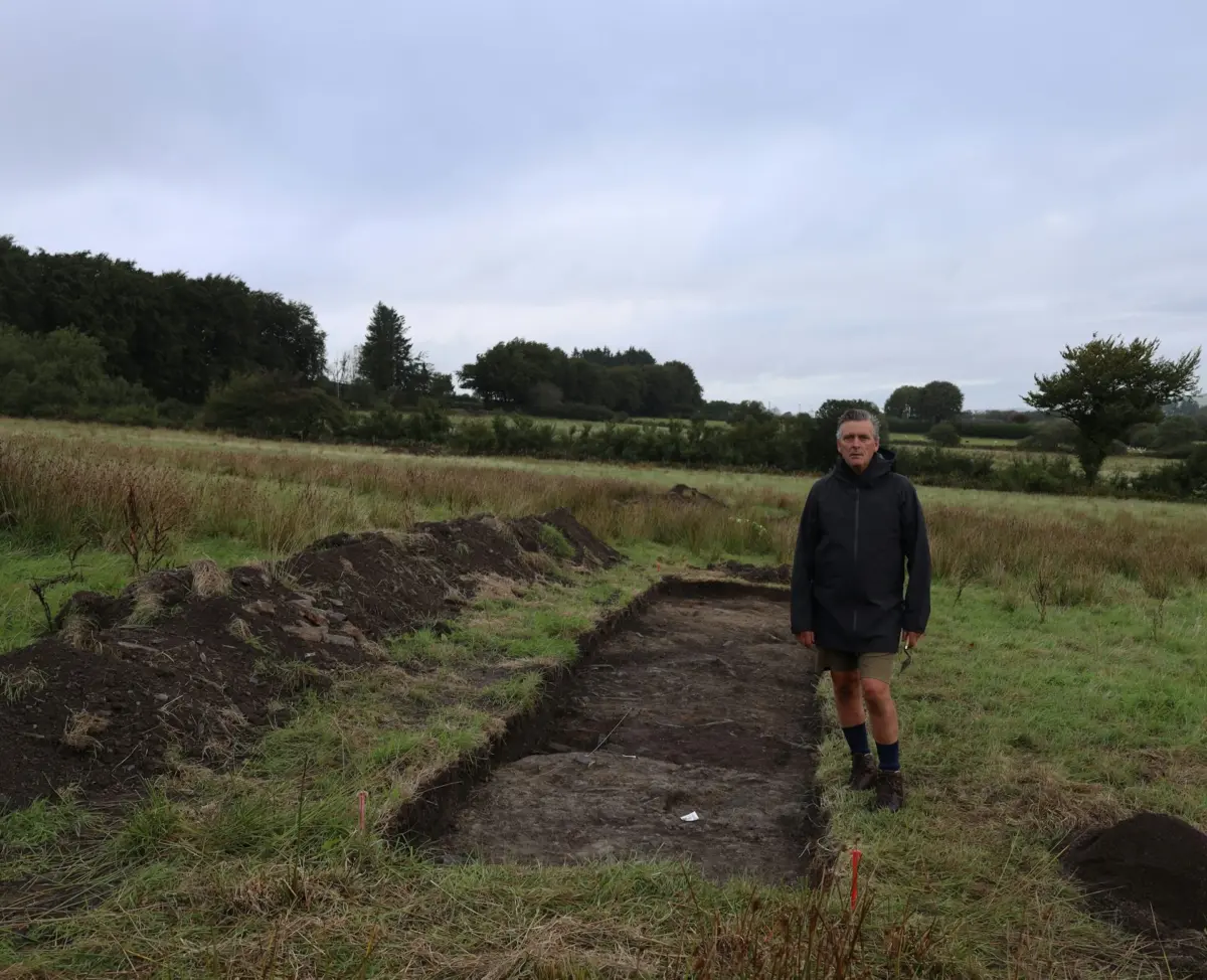
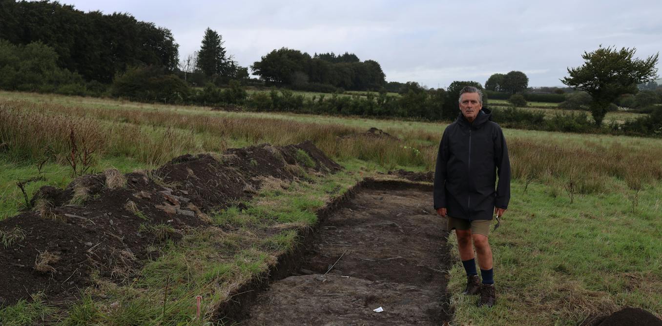
These promising indications led to a comprehensive evaluation excavation in early September 2025, which involved opening five strategic trenches:
- Trench 1 (Headquarters/Principia): Uncovered the clay-and-stone floor foundations of the fort’s administrative hub, revealing structural remnants repeatedly disturbed by decades of modern ploughing.
- Trench 2 (Commander’s House/Civilian Phase): Yielded dense concentrations of pottery sherds, a diagonal alignment of stones indicating a later phase of civilian occupation, and a kiln containing numerous fragments of Roman ceramic tile.
- Trench 3 (Granaries/Horrea): Revealed a heavy clay floor foundation consistent with military granaries designed to keep grain dry and secure.
- Trench 4 (Rampart & Perimeter Road): Unearthed the structural remnants of the rampart base alongside a preserved road surface lying just beneath the plough level, complete with distinct cart-rut marks on the anticipated orientation.
- Trench 5 (Access Track): Confirmed the presence of an arterial trackway up-slope, accompanied by a small recovery of Roman pottery sherds.
Supporting Context & Metrics
To fully appreciate the significance of the Crymych discovery, it is essential to examine the structural dimensions, artifact catalog, and historical timeline that place the site within the broader framework of Roman military strategy in Britain.
Quantifying the Find: Key Metrics
- Site Area: Approximately 3 hectares (7.4 acres), standard sizing for a Roman auxiliary cohort installation capable of housing hundreds of auxiliary infantry or cavalry.
- Geographical Latitude: Aligned with historical military hubs across mid-Wales, bridging Pembrokeshire to the west and Ceredigion to the north.
- Excavation Scope: 5 primary trenches opened in September 2025, following targeted geophysics and preliminary test pits earlier in the year.
- Dating Horizon: Artifact analysis places the fort’s primary operational window in the late 1st century AD (specifically during the governorship of Sextus Julius Frontinus, AD 74–78), with subsequent 3rd- and 4th-century coin evidence pointing to enduring administrative or civilian utilization well into the twilight of the Roman era.
The Artifact Assemblage
The material culture recovered from the trenches provides undeniable confirmation of Roman military and domestic life:
- Numismatic Evidence: A third-century coin paired with two distinct late fourth-century coins, demonstrating multi-generational continuity of use at the site.
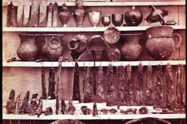
- Administrative & Craft Tools: An iron stylus (used for writing on wax-coated wooden tablets), a woodworking axe, and a lead spindle-whorl, illustrating both administrative literacy and localized industrial activity.
- Recreational & Daily Items: A gaming counter—testament to the leisure activities of off-duty auxiliary soldiers—alongside abundant coarse-ware pottery sherds and stamped ceramic tiles manufactured in an on-site kiln.
Bridging History and Mythology: The Legend of Macsen Wledig
The geographical setting of the Crymych fort offers a fascinating bridge between imperial logistics and medieval Welsh folklore. In The Dream of Macsen Wledig—one of the legendary tales compiled in The Mabinogion—the late fourth-century Roman usurper Emperor Magnus Maximus experiences a vivid dream that draws him across Europe to a wondrous island of Britain, where he beholds a magnificent castle and a maiden seated upon a throne of gold.
In the narrative, Maximus (Macsen) traces his vision to Wales and establishes his camp (Cadair Maxen) on the Frenni Fawr, the prominent easternmost peak of the Preseli Hills. Dominating the landscape just over three kilometres northeast of the Crymych fort, the Frenni Fawr serves as the topographical focal point of the legend.
While surface surveys on the Frenni Fawr have never yielded visible remains of a Roman marching camp, the discovery of a major auxiliary fort directly below its slopes provides the missing physical anchor for the tale. The Roman military presence in this exact corridor during the 4th century—corroborated by late fourth-century coin finds at the Crymych site—suggests that imperial activities in the Preseli foothills left a profound cultural impression on the local Celtic populace, an impression that survived through oral tradition for centuries before being committed to vellum in the medieval period.
Official Statements and Academic Perspectives
The implications of the Crymych discovery extend far beyond regional archaeology, challenging long-held dogmas concerning the western frontier of Britannia.
Lead researchers and project directors emphasize that the alignment between physical earthworks, numismatic dating, and medieval literature represents a rare convergence of academic disciplines. In commentary discussing the ongoing research, lead investigator Dr. Mark Merrony noted:
"The collective findings indicate that the site was once a typical timber fort, probably established during the campaign of the governor Sextus Julius Frontinus between AD 74 and 78. It does indeed suggest a connection between the camp of Magnus Maximus mentioned in the Mabinogion and the site I first identified in 2024."
Highlighting the broader philosophical and historical takeaways of the excavation, project spokespersons underscored how modern archaeological science continues to vindicate early antiquarian observations:
"The earthworks are still visible today, almost certainly adjacent to a major Roman road, and would have been more conspicuous in the 4th century and listed on official itineraries. The discovery represents an extraordinary fusion between myth and reality and demonstrates that folklore is often underpinned by fact."
Academic peers specializing in Romano-British frontier studies have welcomed the findings, noting that the identification of auxiliary forts in west Wales forces a comprehensive re-evaluation of how Rome controlled its peripheral territories, managed local Celtic populations, and secured strategic access routes across the Cambrian mountains.
Future Outlook: What Lies Ahead for the Crymych Project?
With the evaluation excavation phase successfully completed in late 2025, the research team is now transitioning into an intensive post-excavation analysis and long-term preservation strategy.
Immediate Priorities (2026 and Beyond)
- Detailed Artifact Conservation and Analysis: Specialist analysis of the recovered pottery sherds, iron stylus, woodworking tools, and numismatic finds will be conducted to refine the chronological phases of the fort, distinguishing between its initial Flavian military occupation (c. AD 74–78) and its later fourth-century administrative evolution.
- Expanded Geophysical Surveying: While the 2024 and 2025 geophysics successfully mapped the core headquarters and granaries, researchers plan to expand non-invasive scans outward toward the peripheries of the three-hectare enclosure to identify potential auxiliary barracks, auxiliary bathhouses, and extramural civilian settlements (vicus).
- Road Network Mapping: A primary objective for future seasons is tracing the continuation of the suspected arterial Roman road northward toward Ceredigion and eastward into Carmarthenshire, filling in the missing geographic links that perplexed Richard Fenton over two centuries ago.
- Academic Publication and Public Engagement: The findings will be documented in upcoming academic journals and featured prominently in forthcoming historical literature, including Dr. Mark Merrony’s book, Lives of the Roman Emperors: From Augustus to Romulus Augustulus (published via Taylor & Francis). Furthermore, community outreach programs are being developed in collaboration with local Welsh heritage organizations to share these discoveries with schools, local residents, and cultural tourists visiting Pembrokeshire.
Conclusion
The unearthing of the Crymych auxiliary fort stands as a triumph of persistence against historical orthodoxy. By proving that the Roman military machine pushed deep into the rugged heart of west Wales, archaeologists have redrawn the map of Roman Britain. Simultaneously, by forging a tangible link between the timber ramparts of the fort and the legendary Cadair Maxen of The Mabinogion, the discovery offers a breathtaking reminder that beneath the mists of medieval myth and folklore often lie the indelible footprints of true history.